PICTURE
GALLERY
Each
month, at least one special marine image will be published from images
sent to the BMLSS. This
can be of the seashore, undersea world or any
aspect of the marine natural world, especially the underwater life, but
not restricted to life beneath the waves. Topical inclusions may be included
instead of the most meritorious, and images will be limited to the NE Atlantic
Ocean and adjoining seas, marine and seashore species and land and seascapes.

Eelpout,
Zoarces
viviparus
Photograph
by Sandra Turner
This
splendid study of an Eelpout was
photographed in Browns
Bay, Cullercoats,
Tyne & Wear, at around 6 metres depth on 2
August 2017.
This
slippery fish is unknown from the English Channel and inhabits the colder
shallow seas to the east and north of the British Isles and it would be
interesting to know the most southernmost records of where it can be found?
It can even be found in pools on the shore at low tide
amongst the Scottish islands, where it forms part of the varied diet of
the Eurasian Otter
living on the shore.
Click
on the images for the original photographs or links to more images
flickr
MARINE
LIFE of the NE Atlantic GALLERY
Shorewatch
Biological Recording
Gallery
---------------------------------------------------------------------------------------------------------------------------------------------------------------
Shore
Topography Series
The
name of the particular coast should be included and any other interesting
information including the grid reference, if known. Print photographs can
be included in Exhibitions and on the BMLSS Web
Sites and electronic publications.
Electronic
images in *.jpg
format can also be considered for the web site. They should not exceed
1 Mb in size.

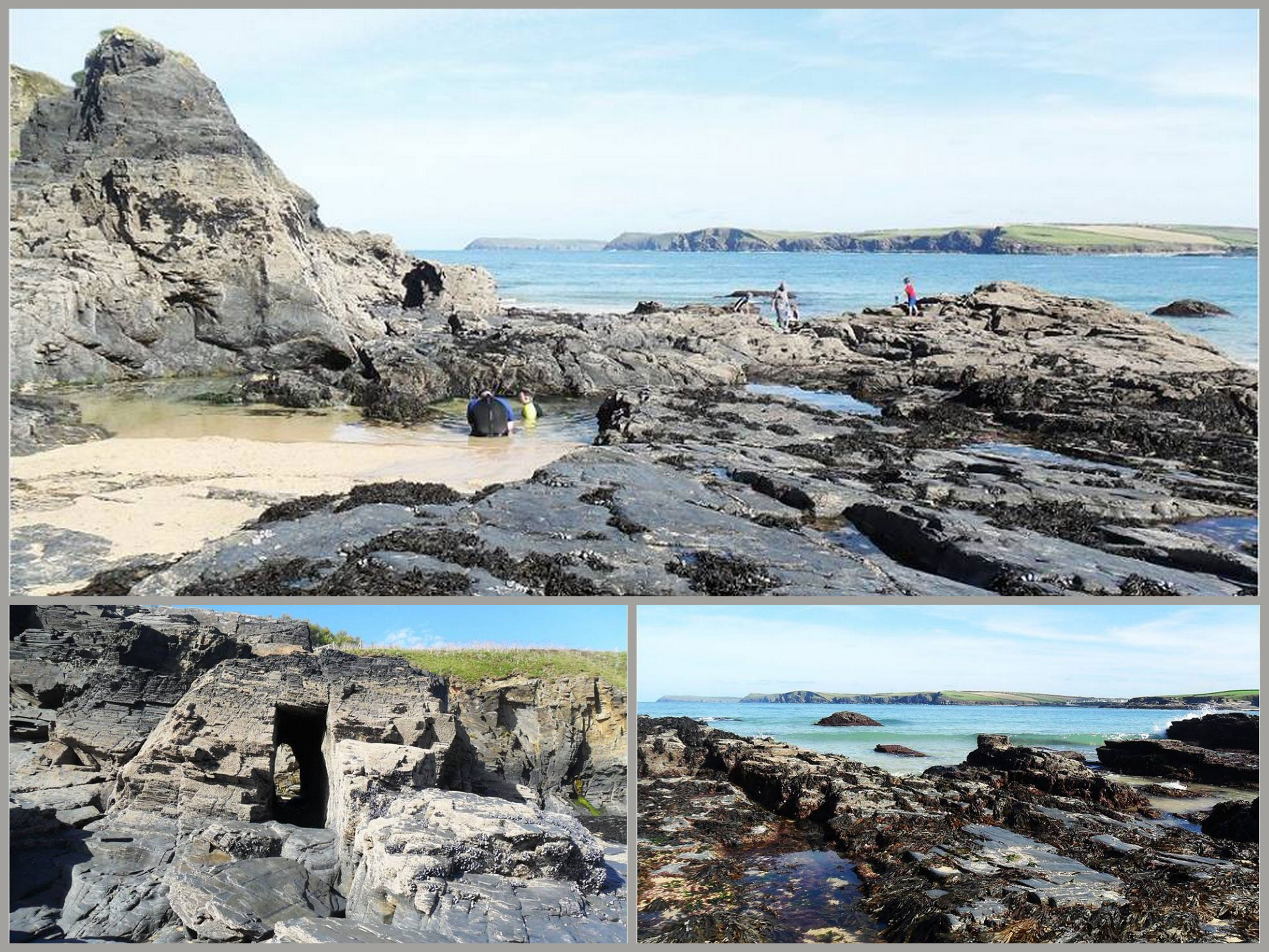
Harlyn
Bay, north Cornwall
Photographs
by Nigel in Cornwall
Some locals have come down
to enjoy some late afternoon fun, centre is a father with his son teaching
him to snorkel in a rock pool.
Harlyn
Bay is a relatively sheltered (=intermediate)
north facing depositing beach near Padstow,
with large expanses of calcareous shell sand and decorative rock formations
and interesting looking rock pools. The third picture is at low tide
(7.5 metre tidal range) with Serrated Wrack
drooped over the slate
rock formations.
Harlyn
Surf Report & Forecast
Harlyn
Bay (Kedhlow Treth): Cornish meaning court
Cove, its about three miles from Padstow
and one mile from St Merryn, Harlyn is a small village on the North Coast
and inland from the bay, Harlyn
Bay is a family beach and also good for surfing, There is a caravan
park near bye, Sadly, most of the homes in Harlyn are holiday lets, To
the east of the bay is Trevone, to the west is Mother Ivey's Bay, and Trevose
Head, further west you will find Constantine
Bay, Porthcothan and Treyamon all can be found along the SW coastal
path. It is in the AONB, area of outstanding beauty along with a third
of Cornwall, In 1865
two crescents of gold were found in the bay, aged back to the Bronze Age,
There are several prehistoric burial mounds nearby. In 2014
after the bay was hit by heavy storms that battered the cliffs, the locals
found it had un covered an ancient burial
cyst containing human remains, after investigations it was found that
it was female and dated back to either Iron or Bronze Age.
Documentary
by Nigel
in Cornwall
Geological
Notes
Click
on the images for the original photographs or links to more images

flickr
British
Coastal Topography
.jpg)
facebook
British
Coastal Topography
----------------------------------------------------------------------------
Flora
and Fauna of Coast and Estuaries


First
enquiry by EMail
to Glaucus@hotmail.com

-----------------------------------------------------------------------

