 Adur
Weather 2009
Selected weather
reports for 2009
Met
Office
Wind
Chill Calculator
Tornado
Intensity
Drought
Conditions
Beaufort
Scale
OnLine
Pressure Convertor
Cloud
Formations
BBC
Weather Review 2006
Link
to the Shoreham Weather Reports for 2008
Link
to the Shoreham Weather Reports for 2010
Met
Office December 2009
25
December 2009
Christmas
Day was cold (2.6
°C at 10:00
am) and clear, with a slight breeze, about
the same as the previous year.
22
December 2009
In
just above freezing (> 1.0 °C)
temperatures, most of the snow in Shoreham town
had melted by midday. Unfortunately,
the air temperature fell below freezing in the early evening threatening
to cause serious ice problems.
21
December 2009
At
3:00
am, the temperature fell to minus
4.6 °C, but the wind direction (Light
Breeze Force 2)
switched from the north to the west in the following hour and throughout
the day, and the temperature rose above freezing resulting in melting snow
and ice. About 3:25 pm,
it began to rain blowing in diagonally from the east. The maximum temperature
rose to 6.3 °C
at 4:00 pm.
 20
December 2009
The
temperature remained above freezing all night after midnight,
but dropped just below at first light, the first minus recorded at 8:00
am at minus 0.5
°C. A significant amount of snow
still lay on grass verges, a small amount of melting occurred causing the
pavements to be hazardous with compacted snow covered in ice.
19
December 2009
The
air temperature fell to a low of minus 4.3
°C at 9:00
am in the morning. No extra snow fell overnight.
The temperature dropped rapidly (3 °C
in an hour) to minus
5.9 °C after dusk at 6:00
pm. The pavements were treacherous under foot.
As the evening wore on, the wind switched around to the west and it got
warmer rising above freezing before midnight.
Lowest
Temperature this Millennium
18
December 2009
The
air temperature remained just above freezing, falling to 0.2
°C overnight. There was 75 mm depth of
snow on the urban pavements (measured outside of my front door). The air
temperature fell below freezing, minus 0.6
°C, at 11:00
am. As dusk fell, the temperature dropped
to a low of minus 2.2 °C
at 6:00 pm.
Shoreham
Weather (Met Office)
17
December 2009
Just
before midnight, several inches of snow fell in blizzard
conditions and
laid despite the air temperature being 0.5
°C. The wind was recorded from the north
and their were icy gusts from this direction, but the snow flakes appeared
to be swirling from all over the place.
November
2009
England
had the the wettest November
on record.
 19
November 2009
Although
the Meteorological
Office site
recorded 25 mph (Force
6 Strong Breeze) south-westerly wind gusting
to 40 mph (Force
8), the whitecaps on the sea were more prevalent
than the previous day.
18
November 2009
A
constant 30 mph
(Force 6 Strong
Breeze) westerly wind gusting to 45
mph (Force 8)
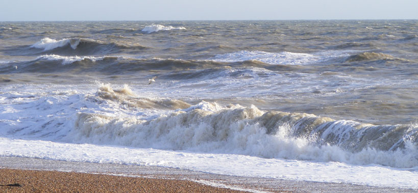
occurred throughout the afternoon. Many whitecaps were forming on the sea
which is indicative of Force 5 to Force 6.
14
November 2009
A
steady 30 mph
(Force 6 Strong
Breeze) southerly wind gusting to 50
mph (Force 9)
occurred throughout the morning, following on from almost as strong winds
throughout the night from 8.00 pm
on 13 November 2009.
At times the steady winds were 35 mph
(Gale Force 7)
and veered slightly towards westerlies. Temperature: 14.5
°C was the highest recorded in the south-east
region. At midday
the wind was 35 mph, Force 7
gusting to 55 mph, Storm Force 10.
These gusts made cycling impractical. From 1.00
pm the wind came with rain. By 1.00
pm the steady wind speed changed to the south-west
and was recorded at 40 mph, Gale Force 8,
gusting to 55 mph, Storm Force 10,
and by 2:00 pm,
the
gusts went of the scale exceeding 65 mph,
Violent Storm Force 11 and rising. The top
gust was recorded at 68 mph. By
3:00
pm the winds reduced to
35 mph, Force 7 gusting to 55
mph, Storm Force 10 and blew from direct west
and continued like this until 10:00 pm
when the wind dies completely to zero.
Shoreham
Weather (Met Office)
Beaufort
Scale
10
-13 November 2009
Continual
poor weather with rain means I think we have seen the last of the butterflies
for the year.
1 November
2009
November
starts wet (heavy rain), windy (Force
6 gusting to Force 8 southerly) and warm
(well nearly warm 15.9 °C
at 10:00 am).
Quote:
November heralds the return of autumn
Big
changes in the weather are now underway as a deep low pressure moves from
Irish Sea to the NE of Scotland. This is bringing a spell of heavy rain
and strong winds across many areas during All Saints Day.
Shoreham
Weather (Met Office)
29
October 2009
The
Indian summer resumes (15.5
°C at
midday).
30
July 2009
An
inclement morning followed by heavy rain in the afternoon excluded butterfly
observations.
29
July 2009
Two
Swallows
flew in the cloudy sky over Mill
Hill and it looked like they were ready
to embark on their return trip, bringing about the first signs the summer
was going to end, before it had even started as far as the fine weather
was concerned.
16
July 2009
The
evening finished with thunder
&
lightning
and
torrential
rain.
7 July
2009
The
solitary Chalkhill Blue Butterfly
seen in the previous few days on Mill Hill,
will not only be lonely but sopping wet after the thunder
and heavy rain throughout
the day.
30
June 2009
It
was warm and humid and the air temperature at midday
was 22.8 °C.
14
June 2009
The
air temperature of 23.5°C
was
recorded during the day, the warmest so far this year.
31
May 2009
The
sun shined and the air temperature reached 22.9
°C and this was probably the warmest day
of the year.
27
May 2009
There
is bright red sky in the morning
over the downs to the north as I look out of my window at 4:45
am. Bad weather is expected.
22
April 2009
I
was not in the mood for recording butterflies
but the sun was out on the warmest day (13.7
°C) so far this year.
10
February 2009
Rain
showers were blown in from the north-west Force
5 gusting to Gale Force 9 in the early morning.
4 February
2009
Almost
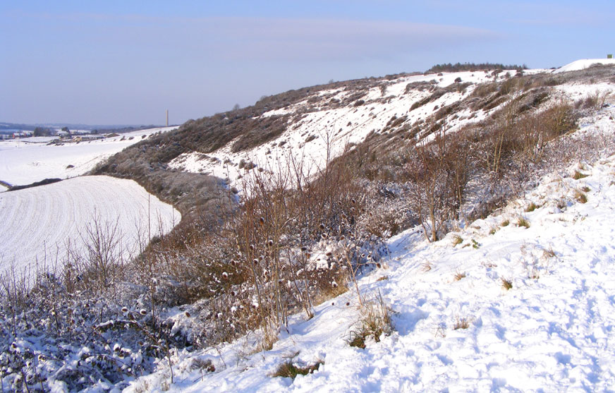
all of the snow had melted, except on the north-facing Mill Hill Cutting
(southern side).
3 February
2009
Most
of the snow melted and the side roads were turned to slush. The temperature
at midday was
plus 3.9 °C. The wind direction switched to a southerly Moderate
Breeze (Force 4).
2 February
2009
A steady
snow
shower was observed at first light. The lowest over night air temperature
was minus 2.6 °C at 2:00 am and
at 8:00 am it
was minus 2.3 °C. The depth of snow outside my front door was
82
mm (over 3 inches) at 9:00 am.
By 10:00 am it
was still 82 mm but there were small drifts to 115 mm. At 2:00
pm the depth of snow was 58 mm. The Gentle
Breeze (Force 3) was from the north. This was
clearly indicated on Mill Hill with the
trees in the copse at the top only collecting snow on the northern side
of their trunks.
1 February
2009
Light
flurries of snow blew in from the east in the afternoon and a thin dusting
settled on the roads. The air temperature fell to freezing point at 4:00
pm.
10
January 2009

Lancing
College Pond (with Hoar Frost)
Photograph
by Ray Hamblett
The
air temperature recorded in Shoreham at 7:00
am at minus
7.3 °C was the lowest this millennium.
There
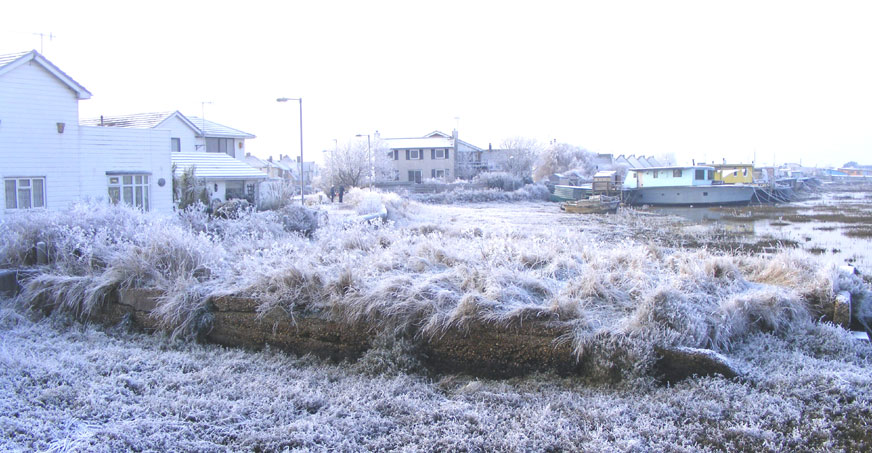
was a considerable amount of feathery Hoar
Frost in the morning. The 'feathery' variety
forms when the surface temperature reaches freezing point before dew begins
to form on it.
Shoreham
Weather (Met Office)
10
January 2009

Mute
Swans showing the depth of the Ice on Widewater
Photographs
by David Wood
Widewater
Lagoon froze over, with the ice thick enough to support the weight
of a
Mute Swan.
Report
by Gordon Croucher (Lancing Parish Council)
7
January 2009
The
air temperature recorded in Shoreham at 4:00
am at minus 6.9 °C was the lowest
this millennium.
Shoreham
Weather (Met Office)
6 January
2009
The
air temperature recorded in Shoreham at 8:00
am at minus 5.7 °C was the lowest
this millennium.
Shoreham
Weather (Met Office)
5 January
2009
A
flurry of snow
fell over night and left a thin layer in the early morning. It had all
melted in town by midday.
Beaufort
Scale
Selected
weather reports for 2008
.
Shoreham
Beach Weather History (New Millennium)
Cloud
Appreciation Society

 20
December 2009
 Adur
Weather 2009

