-
*Notes:
The largest parish church in the UK is theParish
Church of the Most Holy and Undivided Trinity at Kingston-upon-Hull. Its
external length is 87.7 metres (288 ft). It is made of brick and was constructed
circa 1285.
Liverpool Anglican Cathedral has an internal length of 194 metres (636
ft).
The Church of St.
Mary Redcliffe in Bristol, for grandeur of proportion and elaboration
of design one of the most celebrated parish churches in England; but built
1292.
Circencester
Parish Church is large with Tudor additions.
The remains of the largest discovered Anglo-Saxon Church was found at
Circencester and measured 55 metres long. The oldest remaining Anglo-Saxon
church is St. Peter-on-the-Wall,
at Bradwell-on-Sea, Essex dated from AD 654-660. However, the Church of
Winchester (replaced by the Norman Cathedral, 1093) was built by King Cenwalh
of Wessex circa AD 648 and was 30 metres long., although this seems to
be enlarged to a church of a length of 76 metres by the 10th century.
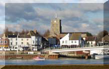
The largest school Chapel is at Lancing
College (on the hill on the opposite of the River Adur
to Mill Hill in the town of Lancing).
It has a capacity of 600. The height of the chapel is 45.7 metres (150
ft).
At the
fall of the Roman Empire there was a powerful penetration of Germanic (Teutonic)
peoples, especially in northern and eastern France. The decline of Rome
left Gaul open to Germanic invasion. Germanic tribes entered in the 3rd
century, but with the increased stability of the Gallo-Roman Empire these
incursions were prevented in the 4th century. The political divisions of
the Roman Empire in AD 395 encouraged Germanic invasion. By the late 5th
century AD the Salian Franks, occupied the area north of the Loire River.
Clovis (ruled 481/482-511), the son of Childeric, unified Gaul with the
exception of areas in the southeast. During the years following his accession,
Clovis consolidated the position of the Franks in northern Gaul.(Ency.
Britannica).
Gauls is the Roman name for the Celtic tribes that occupied France.
.In
1996 the local unemployment rate was 8.7% (the National rate was 6.7% and
the County rate 5.5%). In 1998 the County rate was 6.8%, but in the Brighton
'travel to work' area, including the Adur District, it was 8.1% (September
1998 Report) Over 40% of the jobless have been unemployed for over
12 months, and over 20% for 24 months or more (September 1998). (From
information published in a local newspaper. These
figures are the only ones available, but should be treated with some caution).
For several months in succession during the early 1990s, the Adur District
has shown the highest monthly increase in unemployment for the whole of
the U.K. The jobs lost were in mostly in manufacturing, boat-building (Watercraft)
and mineral extraction (Cement Works).
In October 1999, the unemployment rate for Brighton fell to 5%, but
in some parts of Sussex the rate was below 2% (e.g. Crawley 1.1%). The
national number of unemployed exceeded 1.2 million. (BBC TV).
Census 1981 Adur District statistics:
Population: ?
Population density: 1402 per sq. km (Worthing
is 2820, Brighton 2535)
Foreign born = 3.6%
Pensionable age = 24.4% (Worthing = 34.9%,
Brighton = 24.3%)
Households with car = 63.5% (Brighton = 49.6%,
Horsham District inland area = 78.1%).
Owner occupiers = 73.4% (Brighton was 56.6%),
Council tenants = 19.2%, Private Tenants = 7.4%.
Employment = Manufacturing 22.9% (highest in
Sussex, Brighton was 17.1%), Services 57.3%, Agriculture 0.9%,
Married Women working 59%.
Unemployed 6.2% (Brighton was 11.1%, highest
in Sussex).
Adur unemployment in 1971 = 3.22% (Brighton was
4.72%).
In October 1982, the UK unemployment rate was
13.6%, but the rate in Brighton was 12.6%.
Agenda 21: New figures by Natalie Brahma-Pearl,
Adur DC. (Autumn 2001)
Employment, Public Services = 29%, Business &
Financial Services = 25%, Retail = 20%, Manufacturing & Construction
= 16%, Unemployed = 2.3%. (92.3%).
Working within Adur District = 47%.
Reference for the chalk beds
(too technical for most people): The Chalk of Sussex & Kent by
Rory N. Mortimore, pages 91-96, (Geologist Assoc. 1997) ISBN 0-900717-83-1
-
Geological Page
