ELECTRONIC
NEWS
BULLETIN
FOR
THE
| News & Events |
| Wildlife Reports |
| Words of the Week |
| Historical Snippet |
| Advertisements |
If
you wish to receive this Bulletin, please ask by EMail, specifying the
Adur
Torpedo with your full name.
Glaucus@hotmail.com |
| Web Sites (Local) |
| Poem |
| Computer Tips |
| Games & Leisure |
| Web Sites (****) |
| Events |
|
|
| Adur "World
Oceans Day"
SLIDE SHOW 2000 |
 |
| Wildlife Web Sites |
| LOCAL
ORGANISATIONS |
| LOCAL RESIDENTS PAGE |

This is the first published
Electronic Newspaper for
Shoreham-by-Sea and District,
West Sussex, England
23 August 2000 : Volume 2 Issue 31
Local News
2/3 September 2000
BATTLE OF BRITAIN AIR SHOW
at Shoreham Airport
2 August 2000
The Adur Valley eForum covering all aspects of life in the Adur Valley commences. You can join by spending a few minutes on the following site, and then you can post messages on almost anything about life in Shoreham-by-sea and the Adur Valley, including, Lancing, Sompting, Southwick, Steyning and the smaller villages in the valley.THE BEST WAY TO JOIN THE
is to click on the link to the
logo, and register as a new member. Allow 10 minutes on-line, but the process should be much quicker.
Then you can go to the Adur Valley page and register to join.
The following choices will have to be made:
1) Receive mail in a daily bulletin.
2) Receive each EMail individually (this may result in too many EMails)
3) Choose not to receive EMails, which means you can visit the web page to choose what subjects look interesting. You can, also, just receive a list of the subjects in a daily digest.
If the latter applies, you will have to click on the menu item Messages.4) It is also possible just to receive a daily digest of the subject headings.
These choices can be altered at a later date. They can also be altered by me, if you cannot work out how to do it.
Please send any comments to: Andy Horton
Glaucus@hotmail.com

22
August 2000
A flinty
path leads from the top of Upper Kingston Lane to Southwick
Hill under which the main A27 road burrows a large tunnel which
is hardly noticeable from the vantage point 121 metres above sea level.
A Comma Butterfly flitted
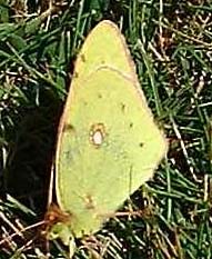
amongst the heather and nettles on the way up. A few Clouded
Yellow Butterflies would not settle,
and a handful of Adonis
Blues settled. Meadow
Brown butterflies were frequently seen.
A pretty little Small
Copper Butterfly settled on some Ragwort
on the path * going downhill east towards Mossy Bottom and up
to New Erringham Farm and Mill Hill. It was harvest time and a pleasant
sunny (22 ° C) day without the excessive humidity of late.
An
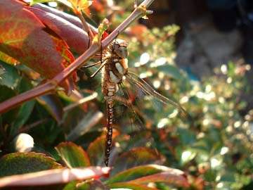
Emperor Dragonfly
hawked at the top of the hedge at the junction of the road from Mill
Hill to New Erringham Farm * .
 20
August 2000
The
immigrant Clouded
Yellow Butterflies are now abundant
near Shoreham Airport, with one every 6 square metres near the perimeter
road (TQ 206 056) on the east side. The grass outfields are a rich tapestry
of mainly Red Clover, Trifolium pratense. (Note: Zigzag Clover
is a very similar plant and may also be present) and Bird's
Foot Trefoil (Bacon & Eggs), Lotus corniculatus.
The unidentified species of butterfly of 7 August 2000 was probably an orange coloured Wall Brown, Lasiommata megera, (It had lots of spots: I cannot think what else it could be) discovered in pairs and singly on the path from the Sussex Pad (TQ 181 064) to Lancing Clump. With its wings closed, on a small rock, this species is very difficult to spot.
Butterflies of Adur
Butterfly Conservation Society (Species List)
A large long-abdomen strong-flying Dragonfly (probably an Emperor Dragonfly) was on the wing, and there could have been a small fritilliary-like butterfly in the woods, that are traversed by a maze of paths.
Wildlife Records on the Adur eForum (you have to join)
Dept. of Trade of Trade
& Industry: Environment
Sites
of Special Scientific Interest
http://www.wildlife-countryside.detr.gov.uk/consult/sssi/Index.htm
Sites of Special Scientific
Interest: Protection from development
http://www.wildlife-countryside.detr.gov.uk/consult/sssi/12.htm#protection
from development.
The Lancing Wildlife page has now been split into two sections: North
Lancing/South Lancing
LancingRing2009.htmray.hamblett/Wildlife/wildlife.htm = North Lancing
LancingRing2009.htmray.hamblett/Wildlife/SouthLancing/Lancsth.htm = South
lancing
I have added some pictures and notes.
Made
a return visit to The Paddocks...
notes and pictures
http://lancingvillage.co.uk/nature/
15
August
A new
page featuring Lancing Beach Green and the adjacent Shingle Beach
LancingRing2009.htmray.hamblett/Green&Shore/Shore.htm
Comments
welcome
Ray
Hamblett
Garden
Wildlife Site
(This
site contains a free database program that looks good, downloads OK,
but I have not made it work yet.)
http://www.users.waitrose.com/~m1ees/wildlifering.htm
http://www.users.waitrose.com/~m1ees/homeframes.htm
EMail:david.walker5@virgin.net
http://groups.yahoo.com/group/ukwildlife
Although crude - I've just
hacked it out of my class intranet site -
this might be of use.
Sussex
Wildlife Trust
For a quick introduction
to habitats in Sussex, see
http://www.wildlifetrust.org.uk/sussex/habitats.htm
For additional ideas, use
the search facilities at:
http://www.foe.co.uk/wildplaces/intros/intro2.html
[wild places in
general]
http://www.wildlifetrust.org.uk/sussex/reserves.htm#map
top [Sussex
Wildlife Trust]
http://www.crabfish.co.uk/birds1.htm
[local birders]
http://www.birding.uk.com/
[top bird sites in UK]
http://www.camacdonald.com/birding/birding.htm
[world birding sites]
Abbot's
Wood, Hailsham. Large plantation, mixed broadleaf and conifer,
with a small lake. Forest
trails, one suitable for
wheelchairs. Main car-park
at Cansheath [TQ 557 072].
Adur.
One of the rivers cutting through the South Downs. Rises SW of
Horsham and flows into the
English Channel at Shoreham. Sea trout, trout, and very good coarse
fishing.
For info on whole valley,
see
Adur-5.htm
RSPB reserve on mudflats
of Adur can be viewed from A259 Norfolk
bridge and footbridge from
High Street. Best in winter.
Estuary.htm
Widewater lagoon is artificial,
see
Brackish.htm.
Mill Hill has its own entry
below.
Amberley
Wild Brooks [TQ 314]. Alluvial floodplain of Arun. Rich
aquatic flora and fauna.
Notable for wildfowl if floods in
winter. Sussex Wildlife Trust.
Can be viewed from footpaths only.
http://www.wildlifetrust.org.uk/sussex/reserves.htm#Amberly
Wildbrooks
Can walk from Amberley rail
station along Wey South Path through
Amberley Wild Brooks to Greatham
bridge and thence to
Waltham Brooks [see below]
or even Pulborough [see below].
Ardingly Reservoir.. 198 acre coarse fishery, pike.
Arlington. Reservoir with
nature reserve. Rainbow trout. Easy walk
from rail station at Berwick
on Lewes to Eastbourne line.
Arun.
One of the rivers cutting through the South Downs. Rises on NW
border of Sussex, flows past
Horsham and enters
English Channel at Littlehampton.
Noted coarse-fish river. Some sea
trout; May to October. Goes
through Arundel and
maintains water for Amberley
Wild Brooks, Pulborough Brooks and
Waltham Brooks [see entries
below].
Arundel.
The Wildfowl & Wetlands Trust centre [TQ 020 081] near
Arundel Castle has a wild
area as well as a captive
collection. You have to pay
to get in. Bittern and Cetti's warbler are
winter specialities.
http://freespace.virgin.net/j.tubb/wwtarund.htm
Arundel
Park [TQ 02 08] has chalk downland with ancient woodland, as
well as recent plantations.
Fine flora and insect fauna.
Pleasant walks.
Ashdown
Forest. http://www.eastsussexcc.gov.uk/ashdown/main.htm
Home of Ecology Field Course
[for EC students only]. To see where you
will be staying
http://www.sussex.ac.uk/Units/conference/iothorns/
Baralavington Down
[SU 965 155] south of Petworth. Chalk grassland
with 'hanging' wood. Access
via footpaths. Close to
Duncton Chalk Pit.
Barcombe
Mills. Quiet river walk. Car park at TQ 435 146. Can walk
north up Ouse. A short loop
can be formed by going to
Anchor Inn [TQ 443 160],
walking west along road to TQ 441 161 and
returning via dismantled
railway.
Barcombe Reservoir. Rainbow Trout.
Barnes, London. Wildfowl
& Wetlands Trust centre, due to open in 2000
is clearly already of the
great bird reserves of the
south east. http://freespace.virgin.net/j.tubb/wwtbarne.htm
Batt
Wood, east of Mayfield. Mixed habitats and great views. There are
two clearly waymarked links
from the road betweeen
Mayfield and Witherenden
Hill [TQ 633 265 and TQ 637 266]. Stonegate
railway station is less than
2 km to the east of the
wood and is linked to Batts
Wood via other public rights of way.
http://www.eastsussexcc.gov.uk/env/cms/pages/sites/bwood.htm
Beachy
Head, near Eastbourne. Dangerous cliffs, but classic bird
migration watchpoint. Fine
chalk flora with maritime element
such as sea beet. East of
Birling Gap is a small area of chalk heath.
Good details at http://www.birding.uk.com/
Ancient earthworks at Belle
Tout
http://csweb.bournemouth.ac.uk/consci/belletout/bt_intro.html
Access to beach at Birling
Gap [TV 554 960] and Cow Gap [TV 597 957].
Bedgebury.
Forest to east of Bewl Water. The National Pinetum at
Goudhurst, Kent, is considered
to be the best conifer
collection in the world by
the International Dendrological Research
Institute [!]. But also well
known for its deciduous trees and
birds, notably crossbills.
Bentley Wildfowl.
Captive ducks etc., but quite a few wild birds.
Entrance on Harvey's Lane
at TQ 477 162.
Bewl
Water. Largest area of freshwater in south east [770 acres], on
Sussex/Kent border just west
of Bedgebury Forest.
Osprey regular. Trout fishing.
http://www.southernwater.co.uk/environment/environ1.asp
Butcher's Wood, Hassocks
[TQ 304 150]. Over 7 ha of semi-natural
Ancient Woodland. Ideal for
Hassocks railway station.
You can hide cars nearby.
Woodland Trust.
Camber
Sand Dunes. Right on top of holiday camp, but still a valuable
part of the Rye-Dungeness
complex.
http://www.eastsussexcc.gov.uk/env/cms/pages/sites/camber.htm
Castle
Hill National Nature Reserve [TQ 367 074] between Falmer and
Woodingdean. Access limited
to footpath through reserve. Footpaths in area surrounding the reserve
give access to other patches of chalk grassland. The whole area between
Newmarket and Itford Hills is famed for its chalk flora and insects,
especially butterflies [nearly 30 species] and Orthoptera [grasshoppers
etc, 13 species]. Ring Ouzel regular on passage.
http://www.english-nature.org.uk/nnr/result.cfm?NNRCode=34
Heavily used by ecologists
from Sussex, e.g.
http://www.biols.susx.ac.uk/Home/Libby_John/
Traditionally visited during
Ecology course.
Chailey
Common. Over 180 ha of heathland with fine views. Five commons
that be accessed off the
A275 running north from
Lewes and or the A272 which
crosses the A275. Three are south of the
A272: Pound and Memorial
Common and Romany
Ridge [car parks at TQ 378
207]. Redhouse and Lane End are to the
north [car park off Warrs
Hill Lane, near TQ 391 217].
http://www.eastsussexcc.gov.uk/env/cms/pages/sites/ccnr.htm
Chanctonbury
Ring [TQ 139 121] near Findon. Small hill fort crowned
with beech trees.
http://www.homeusers.prestel.co.uk/aspen/sussex/chanctonbury.html
Chichester
Harbour [SU 775 005]. Thirty thousand wading birds cannot
be wrong. Huge [over 1100
ha] of channels, tidal mudflats and islands.
Church
Covert, Slaugham, near Crawley [TQ 258 280]. Can leave car near
church. Woodland Trust information
board.
Cissbury
Ring [TQ 140 082], north of Worthing. National Trust. Chalk
grassland with scrub. Fine
flora and good birdwatching, especially at migration times. Park at
TQ 139 085.
http://www.findon.com/cissbury.htm
Costells
Wood, Scaynes Hill, near Haywards Heath [TQ 366 237]. About
21 ha of semi-natural Ancient
Woodland.
Woodland Trust information
board. Leave car in Scaynes Hill.
Cuckoo
Trail. 16 km disused railway from Polegate [just west of
railway station] , past Hailsham,
to Heathfield [TQ 579 215].
http://www.eastsussexcc.gov.uk/env/cms/pages/sites/cuckoo.htm
Cuckmere.
One of the rivers cutting through the South Downs. Formed by
two tributaries, which join
at Hellingly. Reaches sea
at Cuckmere Haven between
Seaford Head and the Seven Sisters Country
Park [see entries for both
of these]. Mainly coarse
fish, roach, bream, chub,
carp, perch, dace and pike.
South Downs Way runs though
this area
http://www.nationaltrails.gov.uk/sdowns/swaysub5.htm
Ditchling
Beacon [TQ 331 133], north of Brighton between University
and Ditchling. National Trust
and Sussex Wildlife Trust.
Chalk grassland, scrub and
ash woodland. Enormous views.
http://www.wildlifetrust.org.uk/sussex/reserves.htm#Ditchling
Beacon
Ditchling
Common. Mixed habitats. Car park at TQ 336 180.
http://www.eastsussexcc.gov.uk/env/cms/pages/sites/dccp.htm
Duncton
Chalk Pit [SU 960 163], south of Petworth. Under beech
'hanger'. Striking flora
[e.g. deadly nightshade] and rich
insect fauna. Close to Barlavington
Down [see above].
Dungeness,
Kent [TR 063 196]. Admittedly a hack to get to [bus 711
from Churchill square in
Brighton to Lydd takes over 3
hours], but incredible shingle
site including RSPB reserve.
http://www.shepway.gov.uk/index/tourism/group/rspbresv.htm
The reserve entrance is at
Boulderwall Farm about halfway between Lydd and
Dungeness.
Birdwatchers should check
details at http://www.birding.uk.com/
Ferry Field. Viewable
reserve at Pagham.
http://www.wildlifetrust.org.uk/sussex/reserves.htm#Ferry
Field
Fore Wood [TQ 756
126], Crowhurst north of Hastings. RSPB reserve,
very close to Crowhurst station.
Can leave cars opposite church. Lovely wood.
Footland Wood, Vinehall
Street, near Battle. Mixed plantation.
Car-parking off B2089 at
TQ 764 202. Bus No 4
(Hastings-Maidstone) goes
past.
Forest Way. 15 km
of disused railway running from East Grinstead to
Groombridge where links to
Sussex border path. The main access point is from Forest Row where it
is easy to park. There
is also a small layby at
Ham Bridge [TQ 364 369] near
Groombridge.
http://www.eastsussexcc.gov.uk/env/cms/pages/sites/fway.htm
Friston
Forest, between Seaford and Eastbourne [TV 526 996]. Good
birdwatching site. Car park
at TQ 518 003 has marked trails. Forest rides attract butterflies and
include variety of flowering plants.
Highdown
Hill, west of Worthing. Open access, National Trust. Car park
at TQ 098 043.
Hope Gap, near Seaford. Traditionally visited during Ecology course.
Iping Common, west
of Midhurst. Adjacent to Stedham Common. Heathland.
Car park at SU 853 220.
Kingley
Vale National Nature Reserve [SU 824 088], northwest of
Chichester. Valley with chalk
grassland and best yew
woodland in Europe. Amazing
flora, excellent butterflies [34 species]
and good birdwatching [hawfinches
breed]. For yew, see
http://www.rfs.org.uk/totm/yew.htm
Friends
of Lancing Ring
http://www.lancingring.org.uk
Levin
Down [SU 888 131], north of east Chichester. Chalk grassland with
juniper scrub.
http://www.wildlifetrust.org.uk/sussex/reserves.htm#Levin
Lullington Heath National
Nature Reserve [TQ 545 018] between Lewes
and Eastbourne. Chalk heath
with mixture of chalk
flora with calcifuge species.
Nightingales. Access restricted to
footpaths.
http://www.english-nature.org.uk/nnr/result.cfm?NNRCode=106
Site of some of Libby John's
research
http://www.biols.susx.ac.uk/Home/Libby_John/
Malling Down, Lewes.
Sussex Wildlife Trust. Chalk grassland, flowers &
butterflies. Long barrow
and tumuli. Footpath to Mount Caburn [see below].
http://www.wildlifetrust.org.uk/sussex/reserves.htm#Malling
Down
Markstakes Common,
South Chailey. Woodland with footpaths off
Markstakes Lane which runs
east off A275. Best path
strikes southwest from TQ
399 184.
http://www.eastsussexcc.gov.uk/env/cms/pages/sites/mstakes.htm
The
Mens, between Petworth and Billingshurst [TQ 023 237]. Glorious
ancient woodland.
http://www.wildlifetrust.org.uk/sussex/reserves.htm#The
Mens
Mill Hill [TQ 212
067], Old Shoreham. Chalk grassland overlooking Adur.
MillHill.htm
Mount
Caburn National Nature Reserve east of Lewes . Open access. Hill
fort on chalk grassland with
some scrub. Noted for sweetbriar, a rare rose. Connected by footpath
to Malling Down [see above].
http://www.english-nature.org.uk/nnr/result.cfm?NNRCode=99
For excavations at hillfort,
see http://www.sussexpast.co.uk/mount.htm
Newhaven. Breakwater
at TV 447 999. Can see various seabirds. Walk to
Saltdean passes large Kittiwake
colony and likely to see Fulmar andPeregrine.
Walking on rocky shore is DANGEROUS and advise footpaths on cliff tops.
Old Lodge [TQ 460
302]. Sussex Wildlife Trust reserve on Ashdown
Forest.
http://www.wildlifetrust.org.uk/sussex/reserves.htm#Old
Lodge
Ouse.
One of the rivers cutting through the downs. Rises south-east of
Horsham, passing through
Lewes on its way to the sea at Newhaven. Tidal from mouth to about 6
km upstream of Lewes. Notable for run of big sea trout. The walk between
Lewes and Newhaven is easy and well served by public transport.
Nap
Wood [TQ 583 327]. Sussex Wildlife Trust. Traditionally visited
during Ecology course.
http://www.wildlifetrust.org.uk/sussex/reserves.htm#Nap
Wood
Pagham
Harbour [SZ 857 965]. Tidal saltmarsh, shingle.
Birdwatchers should check
details at
http://www.birding.uk.com/
http://www.pinkmoose.ic24.net/uk/sussexframe.htm
Pictures at
http://www.bapfish.org.uk/sights/pagham.html
Sussex Wildlife Trust Reserve
http://www.wildlifetrust.org.uk/sussex/reserves.htm#Ferry
Field
Friends of Pagham Harbour
http://www.btinternet.com/~friendsofpaghamharbour/
Park
Wood, Hellingly, north of Hailsham. Bluebell
wood [TQ 593 127].
Wonderful fungi in autumn.
http://www.eastsussexcc.gov.uk/env/cms/pages/sites/pwood.htm
Powdermill Water, Sedlescombe. 52 acres. Brown & rainbow trout.
Powdermill Wood,
south west of Battle [TQ 735 145]. Wet alder
woodland. Car park off B2095.
http://www.wildlifetrust.org.uk/sussex/reserves.htm#Powdermill
Wood
Pulborough
Brooks RSPB reserve in Arun Valley. Has cycle facilities
and binocular hire. Charges
for non-RSPB members [October 1999 these were adult £3.50, child
£1, concession £2.50,
family £7].
Visitor centre open daily
10 am to 5 pm.
3 km from rail station at
Pulborough. Hourly bus [number 100], except
Sundays and Bank Holidays
between Pulborough Station and Steyning. Ask to get off at Wiggonholt.
More adventurously, two footpaths run from Pulborough: TQ 053 186 [car
park] and TQ 062 184 [entrance to Brook Gate farm].
Alternatively, walk from
Amberley rail station through Amberley Wild
Brooks [see entry above]
to Greatham bridge and Waltham Brooks [see below]. From there can retreat
east along minor road until reach path to Pulborough.
Birdwatchers should check
details at http://www.birding.uk.com/ [click
on bird sites].
For more information and
details of RSPB reserves elsewhere, see
http://www.rspb.org.uk/
Saddlescombe
Chalk Pit [TQ 268 122], northwest of Brighton. Chalk
flora and juniper scrub.
http://www.wildlifetrust.org.uk/sussex/reserves.htm#Saddlescombe
St.
Leonard's Forest. Large plantations conceal three small reserves.
Sheepwash Ghyll (TQ 215 304,
Ghyll woodland and stream), Mick's Cross
(TQ 208 299, Beech pollards
and heath) and Lily
Beds (TQ 212 308, Lily-of-the-Valley).
http://www.wildlifetrust.org.uk/sussex/reserves.htm#St.
Leonards
Forest
Seaford
Head. Chalk cliffs. Fine flora. Fine Kittiwake colony at
extreme west of cliffs, viewable
from end of promenade. From
rail station, move south
to sea.
http://www.inn-quest.co.uk/seaford/head3.htm
Selwybn's Wood, Cross
in Hand South of Cross-in-Hand. Off A265 [TQ 552
206].
http://www.wildlifetrust.org.uk/sussex/reserves.htm#Selwyns
Wood
Seven
Sisters Country Park [TV 51 99], between Seaford and Eastbourne.
Car park off A259 to east
of river. Varied flora from saltmarsh to fine chalk grassland. Good
for all-round natural history.
Shoreham.
See entries for Adur and Mill Hill. The shingle beaches are
more interesting than they
look,
Coastal.htm
Stedham Common, Midhurst
[SU 856 218]. Adjacent to Iping Common.
Heathland. Use car park at
SU 853 220 and cross
minor road.
http://www.wildlifetrust.org.uk/sussex/reserves.htm#Stedham
Rivers. See entries for Arun, Adur, Ouse and Cuckmere [west to east].
Rye
Harbour. Mixed habitats including shingle and saltmarsh. Has own
website http://www.yates.clara.net/
Easily reached by public
transport, despite distance from campus:
http://users.ox.ac.uk/~mert0096/publictransport.html
Forms part of the Rye Bay
complex
http://www.yates.clara.net/2bryebay.html.
This includes one of
David's study sites and the
Sussex Wildlife Trust reserve at Pett Pools
http://www.wildlifetrust.org.uk/sussex/reserves.htm#Pett
Pools
Birdwatchers should check
details at http://www.birding.uk.com/
Saddlescombe
Chalk Pit, NW of Brighton. Chalk grassland with Junpier
bushes. Sussex Wildlife Trust.
http://www.wildlifetrust.org.uk/sussex/reserves.htm#Saddlescombe
Sullington Warren,
Storrington. Open access National Trust. TQ 095
144.
Vanguard
Way. From Seaford railway station to Cuckmere Haven [see
entries] is an interesting
walk.
Waltham
Brooks [TQ 025 158], southwest of Pulborough. Sussex Wildlife
Trust. Access from footpaths
only. Leave car at Greatham Bridge [around TQ 030 163] on minor road
between A29 and Storrington. If using public transport, walk from Amberley
rail station through Amberley Wild Brooks [see entry above]
to Greatham bridge. From
Waltham Brooks can retreat east along minor road until reach path to
Pulborough [see entry above].
http://www.wildlifetrust.org.uk/sussex/reserves.htm#Waltham
Brooks
Washington Warren, Washington. Open access National Trust.
Weirwood
Reservoir. Trout fishing. Good birdwatching from hide and
viewing area off Legsheath
Lane at south west of the
reservoir. Reserve lane leaves
road at about TQ 388 342. Sussex border
path runs just to north of
reservoir giving intermittent
views. http://www.eastsussexcc.gov.uk/env/cms/pages/sites/wwood.htm
West Park, Uckfield.
Small but interesting. Martyn Stenning [4B14] is
involved with this local
reserve. Entry through Batchelor Way off the B2102 immediately after
the turn off from the A22 [TQ 464 210].
http://www.eastsussexcc.gov.uk/env/cms/pages/sites/wpark.htm
William's
Wood, Warninglid, near Horsham [TQ 239 263]. A small(4.0 ha)
area of semi-natural Ancient
Woodland in a well wooded area. Woodland Trust.
Woods. More details
of more woods at the following sites
Britain http://www.woodland-trust.org.uk/
East Sussex http://www.woodnet.org.uk/woodlandweb/
Woods
Mill, south of Henfield [TQ 218 137]. Small but genuinely
interesting area of woodland
and wet bits. HQ of Sussex
Wildlife Trust. Excellent
information centre.
Dr
David Harper
School
of Biological Sciences
University
of Sussex, Brighton BN1 9QG
Mapmate for Biological Recording
MapMate provides for all
of your recording needs in a single application,
Capacity in excess of 10
Million Records,
Rapid and easy to use data
entry with a host of built in features to assist your recording like:
'early and late dates' or 'any recent records for this species',
Built in sharing of data
between MapMate users,
Automatic creation of Distribution
Maps and Atlases directly from your data,
Distribution maps automatically
up-date as you enter data - no need to keep re-making them!
Maps for all GB counties
included. Ireland and Channel Islands being added at the moment,
Built in queries and reports
- plus we will customise or create any new reports for nothing...just
email your exact requirements,
Copy and Paste presentation
quality maps and tables into other Windows applications.
Fishbase
(Fishes of the World)
Fish
List (British Marine)
British
Naturalists' Association (link)
Find
the Sites of Special Scientific Interest using this link:
Friends
of the Earth SSSI Navigator
- gamut
n. LME. [Contr. of med.L gamma ut, f. GAMMA name of the symbol (not
included) (repr. in the Middle Ages a note one tone lower than A)
+ UT first of the six notes forming a hexachord.] I Mus. 1 Hist. The lowest
note on the medieval sequence of hexachords, equal to modern G on the lowest
line of the bass stave. LME. 2 Hist. A large scale (ascribed to Guido d'Arezzo),
formed of seven hexachords or partial scales, and containing all the recognized
notes used in medieval music. L15. 3 The full range of notes which a voice
or instrument can produce. M17. 4 The major diatonic scale; the scale recognized
by any particular people or in any period. E18.
-
Star:
Latest Virus Information
II 5 transf. & fig. The
whole range or scope of something. E17.
5 C. BEATON Her resonant
voice covers the gamut from an emphatic whisper to an almost Rabelaisian
roar.
Rabelaisian a. & n. E19. [f. Rabelais (see below) + -IAN.] A adj. Pertaining to, characteristic of, or resembling the French satirist François Rabelais (c1494-1553) or his writing; marked by exuberant imagination and language, coarse humour, and satire. E19. B n. An admirer or student of Rabelais or his writing. L19.Rabelaisianism n. the characteristic style or attitude of Rabelais; a Rabelaisian feature or characteristic: L19. Rabelaism n. Rabelaisianism E19.
---------------------------------------------------------
Excerpted
from The Oxford Interactive Encyclopedia
Developed
by The Learning Company, Inc. Copyright (c) 1997 TLC Properties Inc.
Computer Tips
The upsurge of EForums
on all subjects (a
few have been recommended before in these bulletins) are an important way
in which the Internet
will change the world.
Poem of the Week
- On
the Grasshopper and Cricket
-
- Sussex Web Sites
The poetry of earth is never
dead:
When
all the birds are faint with the hot sun,
And
hide in cooling rees, a voice will run
From hedge to hedge about
the new-mown mead --
That is the Grasshopper's.
He takes the lead
In
summer luxury; he has never done
With
his delights, for when tired out with fun
He rests at ease beneath
some pleasant weed.
The
poetry of earth is ceasing never:
On
a lone winter evening, when the frost
Has
wrought a silence, from the stove there shrills
The
Cricket's song, in warmth increasing ever,
And
seems to one in drowsiness half lost,
The
Grasshopper's among some grassy hills.
-
- Historical Snippets
1938
Passenger air services in
operation from Shoreham Airport to Jersey, Birmingham and Liverpool. The
railway station serving the airport was originally called Bungalow Town
Halt (opened 1910), but renamed Shoreham Airport Station (in 1935), the
first station to serve an airport in England, in 1930.
-
- http://appspace.nexus-solutions.net/arc/asp/diary/diaryoutput.asp
- Please send in any details of local events.
Events
2/3 September 2000
BATTLE
OF BRITAIN AIR SHOW
at
Shoreham
Airport
Web Sites
1 August
2000
TheBritish
Marine Wildlife Forum commences. PLEASE
JOIN

BRITISH MARINE WILDLIFE FORUM PAGE |
- SPONSORSHIP OPPORTUNITY
For any company or organisation wanting nationwide green publicity, there is an opportunity to sponsor the journal "Glaucus" of the British Marine Life Study Society.
There remains sponsorship opportunities on the BMLSS (England) web site and other publications, including Torpedo.
Sponsorship is also available for the Adur Torpedo Electronic News Bulletin and the Shoreham-by-Sea web pages (which preceded the Adur Resource Centre web site), which would be more suitable for a local firm(s).
Web Site Design Services are available from Hulkesmouth Publishing
Normal
advertisement rules apply.
Submissions
accepted by EMail only.
Adur Torpedo was written, designed and distributed by Andy Horton.
Links
to earlier issues (for subscribers who have downloaded the Bulletins only,
and web site visitors).


