CYCLE
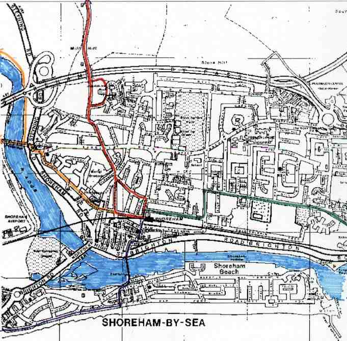
ROUTE MAP (ADUR VALLEY)
Off-road* routes are unsuitable
for racing cyclists.

Red
Route:
Railway Station - Mill Lane (or
Southdown Road) - Upper Mill Lane - Erringham Road - Mill Hill Road - Mill
Hill > Truleigh Hill
Purple
Route:
Railway Station - Brunswick Road
- East Street (one way street adjacent to St. Mary's Church) - Footbridge
- veer right (west) - Weald Dyke - veer right (west) - Beach Road, follow
road & tracks running parallel with the sea > *
Widewater
Green
Route:
Railway Station - Buckingham Road
- first right, Gordon Road - left, Eastern Avenue - second right, Middle
Road - St Julian's Close > Kingston Buci
Yellow
Route:
Railway Station - first left north
of crossing gates - Connaught Avenue - Old Shoreham - Toll Bridge (or turn
right for the * cycle
path on the east side of the river with a connection to the South Downs
Way & path that ends at Bramber Castle) > straight-on to Sussex Pad,
for Coombes Road, routes to Worthing (or turn right for *
towpath
on west side of the river).
Cycling
around Shoreham
Because Shoreham is located on the flat plain
at the foot of the downs, cycling is popular and would be an ideal way
to get around, if it was not for the traffic and the bad condition of many
of the roads.
-
Cycles can be taken on the old slam door trains
on South Central Railway free of charge without prior reservation. However,
a reservation is needed on the diesel multiple unit Stagecoach and AlphaLine
regional trains to south Wales and other destinations in the west.
-
-
Routes
suitable for cycling (Off-road* routes are unsuitable for racing cyclists):
-

-
* A
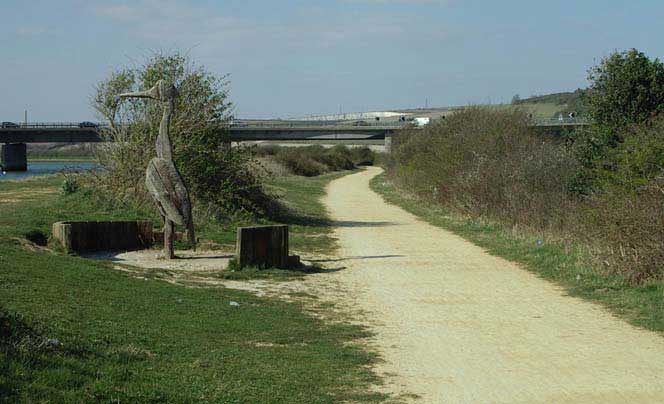
gravel cycle path has been constructed from the eastern
end of the Toll Bridge in Old
Shoreham going north. It is an excellent cycle route for casual cycling.
When you arrive at the South Days Way Bridge over the River
Adur, you should cross the bridge and head for a short distance west.
At the first T junction the route north takes you to the roundabout near
Bramber Castle crossing the main road on the way. If you continue following
the South Downs Way west you will arrive at the village of Botolphs.
The towpath on the east bank of the river can be cycled on into the centre
of Bramber but you may need to lift your bike over stiles. Yellow
Route on Map
-

-
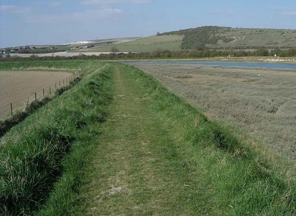
* A towpath on the west bank
of the River Adur runs from Adur Recreation Ground on the south side of
Norfolk Bridge and runs north adjacent to the airfield and as far as Bramber.
Progress is impeded by a number of stiles and after a spell of wet weather
can be very muddy.
-
Coombes Road
-
A good cycling country road runs north from the
Sussex Pad (north west of the airfield, accessible over the old wooden
Toll Bridge from Old Shoreham, or from the airport road) through Coombes
and Botolphs to Steyning or Bramber. The road ends up at the roundabout
at the entrance to Bramber Castle. The return route is called Mauldlin
Road and it starts with a small climb.
-
From the Sussex Pad to Lancing - route from Old
Shoreham over the Toll Bridge to North Lancing and Sompting - the practical
route is to use the path on the south side of the main A27 in both directions
because this road is much too dangerous for cyclists. In Lancing, a road
to the south runs parallel to the main road.
-
MAP
(Link): On this map, the route
to take is the most northerly yellow (secondary) B road that runs parallel
with the A27 red road (see the instructions immediately below.)
-
This from the east (accessible south down Grinstead
Lane at the first roundabout at the Manor in Lancing from the east) is
Crabtree Lane/Cokeham Road/West Street and goes all the way to Worthing,
avoiding the through traffic. A local road map helps, and this will be
printed on this web site when the equipment is good enough.
-
*
There
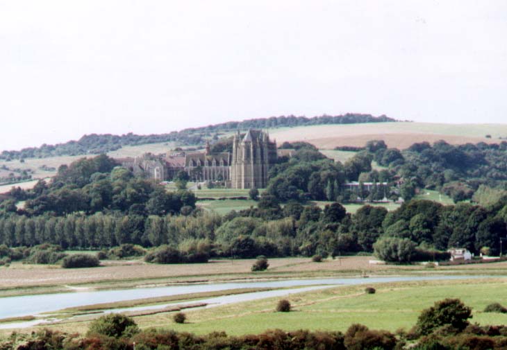
is a country path usable by mountain bikes running from just north of the
Sussex Pad west towards Lancing Clump. This a bridlepath branch off the
road to Lancing College. The path to Lancing Clump
can also be accessed from the A27 opposite the garage (west of the Withy
Patch) and taking the tarmaced private road up the incline to Hoe Court
Farm (then turning left up a further incline). A more attractive alternative
to the tarmaced road is choose of two routes north of Lancing Manor car
park heading directly north into a wild meadow, or veering east and taking
the path through the wood, which takes you out into the upper meadow.
-

-
An old country road runs from Mill Hill over the
downs towards Truleigh Hill Youth Hostel. This road is not marked by signs,
but look for Erringham Road leading to Mill Hill Road. At the Beeding
Hill crossroads about three miles north of Mill Hill the route west
is an unadopted road (* a recent visit, 1998, indicates
that this stretch downhill is only cyclable with mountain bikes, and it
may be better to cycle down the steep path adjacent to Anchor Bottom instead)
that leads to a place called Castletown on the main road from Upper
Beeding (east at the Rising Sun junction) to Woods Mill (Sussex Wildlife
Trust) and Henfield. The path north at the crossroads is difficult to cycle
and may be too muddy to ride. It ends at the Beeding-Henfield (Golding
Barn#) road further north. More routes from there, but a mountain bike
is necessary. Red Route on Map
-
(# adjacent to Golding Barn Garage, the path leads
up an incline to a small summit and down to Manor Road, 100 metres east
of the Rising Sun PH)
-
 *
The Coastal
Cycling Route West is not marked by signs. It starts at the footbridge
by Coronation Green where cycling is forbidden.
The route is to follow the roads south for a minute or so until you can
see the sea (or a shingle bank), and then cycle west along roads which
change into a concrete road/path adjacent to Widewater
Lagoon (cycling is permitted #)
leading to south Lancing and eventually Worthing. (The road from Beach
Green to Worthing is much more dangerous for cyclists than it appears,
especially in bad light. The reason for this is that the width of the road
does not allow room for both lorries and cyclists. The speed limit is 40
m.p.h. and in some areas the traffic can actually reach this speed, but
it is often too busy during the day.) Most cyclists use the path on the
sea side of the road. Purple
Route on Map
-
(# Legal advice has been
obtained on this issue)
-
It is a good idea when travelling the Coastal
Route East to Hove and Brighton to cross over the Lock Gates at Southwick
(look for the sign for Carrot's Cafe) and cycle along the lightly used
private port road to Aldrington Basin (at the east end of Shoreham Harbour)
and Hove Lagoon, where the *
Brighton
and Hove coastal cycle lane starts. The road from Shoreham footbridge going
east along the main coast road towards the Lighthouse is very dangerous
and cyclists have been killed along this route. There is an inland route
through east Shoreham (footbridge - lock gates) along Middle Road but you
may need a map. The route will be published on this site when I get a new
computer etc. Green Route on Map
-
The bridlepath
north of Upper Kingston Lane leads to Southwick
Hill but there are a lot of flints and its advisable to take a puncture
repair kit. It is a steady slope to 120 metres above sea level. At Southwick
Hill there is a route east towards New Erringham Farm and Mill
Hill. (There is also a path from Slonk Hill to New Erringham that runs
along the edge of arable fields.) From Southwick Hill there path
rises another 50 metres to Thundersbarrow and a long trip over to Truleigh
Hill. These routes need mountain bikes, and may be impassable after
rain.
-
However, the car is still the fastest way to get
around despite the congestion, e.g. in the rush hour a trip from the Adur
Civic Centre to Lancing Manor (a route favourable to cyclists) will take
about 10 minutes by car and 15 minutes by bicycle. Bicycles are generally
superior to buses for trips up to 5 miles.


 *
The Coastal
Cycling Route West is not marked by signs. It starts at the footbridge
by Coronation Green where cycling is forbidden.
The route is to follow the roads south for a minute or so until you can
see the sea (or a shingle bank), and then cycle west along roads which
change into a concrete road/path adjacent to Widewater
Lagoon (cycling is permitted #)
leading to south Lancing and eventually Worthing. (The road from Beach
Green to Worthing is much more dangerous for cyclists than it appears,
especially in bad light. The reason for this is that the width of the road
does not allow room for both lorries and cyclists. The speed limit is 40
m.p.h. and in some areas the traffic can actually reach this speed, but
it is often too busy during the day.) Most cyclists use the path on the
sea side of the road. Purple
Route on Map