 |
|
|
 |
 |
 |
|
|
 |
| SHOREHAM-BY-SEA HOMEPAGE |
| Airport |
| Brief History |
| Character |
| Harbour |
| History |
| Landscape |
| Politics |
| Services |
| Toponymy |
| Town Centre Houses |
| Wildlife |
Bungalow Town (pre-WW2). Business & Trade (1990's). Modern Map. Ancient Times.
The High Street is now
the coast road (A259), with the south side bordered by the River
Adur, obscured mostly by a row of shops and Public
Houses, with gaps where
Public
Hards should provide access to launch boats into the River Adur. The
footbridge from Coronation Green at the east end of the High Street leads
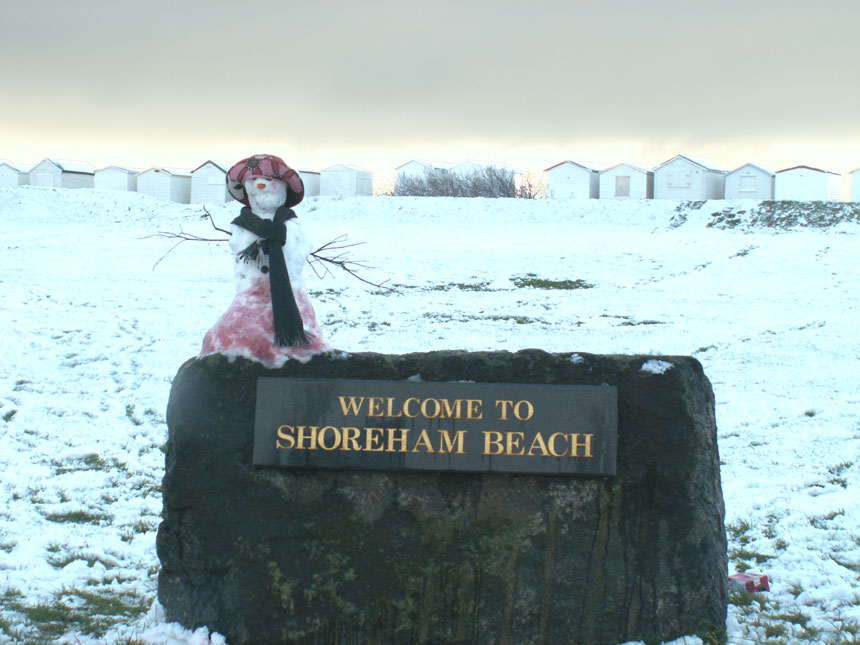
on to the area known as Shoreham Beach.
Link
to photograph of the Footbridge over the River Adur to Shoreham beach.
Bungalow Town
From the beginning of the century the beach area was a theatre and film colony with people living in redundant railway carriages. The carriage had their wheels and bogies removed and were fixed to a concrete raft over the shingle.Film Studios were constructed and from about 1913 many films, including the first production of 'Little Dorrit', were made on Shoreham Beach. The film industry collapsed but many of the people involved remained in Shoreham and opened shops. All cinemas in Shoreham and the Adur District are now closed. The first cinemas in the 1920s were the Star (1910-1926), Bijou Electric Empire renamed the Duke of Yorks (1911-1931), and the Coliseum (1920-1941). The Coliseum survived until World War II. A new cinema called the Norfolk and then the Ritz was opened in 1933 on the edge of Ropetackle. One of the last films showed there was "From Russia with Love" in 1964. It became a Bingo Hall and a warehouse before it was demolished in 1970.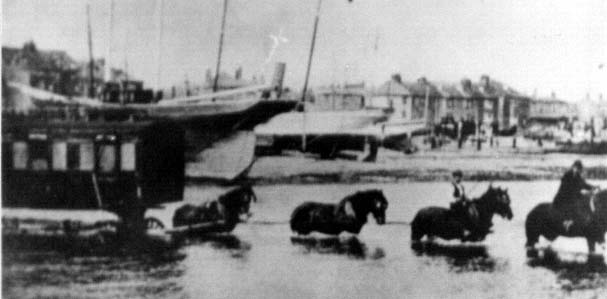
Old Railway Carriages being floated across the River Adur
In the early 1920's the Prospect Film Company issued the following prospectus:
- "The climatic conditions of Shoreham-by-Sea are particularly suitable, and peculiarly adapted for daylight production. Facing the south of the famous Downs the air is wonderfully clear, and quite free from fogs, and, as the studio is situated on a spot at least 50 miles away from any real smoke, a pure and clean light may be obtained, probably unrivalled by any other place in England. East and West of the studio are the towns of Brighton and Worthing. To the south is 70 miles of open sea, while to the north are situated the Downs famous in song and story, undoubtedly the Los Angleses of English production".

Star
Gap Hard, off Shoreham High Street,
before
the construction of the Footbridge and before Coronation
Green
The
new Adur Ferry Bridge
Opening
Day 13 November 2013
Shoreham Beach is mostly shingle and the soil for lawns etc. has been introduced.
NB:
The
strata of the site consist of gravel and sand and a lignite formation known
locally as "Stromboli" which was found generally on the site at about 35
to 50 ft. below the surface level; beneath this is a load-bearing layer
of clay and chalk.
The
quote above came from the following external site referring to the foundations
of the old Power Station, built on the same
sort of land (beneath the shingle) as Shoreham beach.
(Shoreham)
Brighton 'B' Power Station (Southwick)
References and further information are available for all the entries on this Web Site. Please enquire by EMail.
Shoreham BeachShoreham Sailing Club (External Link)
Modern Day Shoreham-by-Sea

River
Adur at Dusk
View
of the Adur Ferry Bridge from the Norfolk Bridge
Opened
13
November 2013
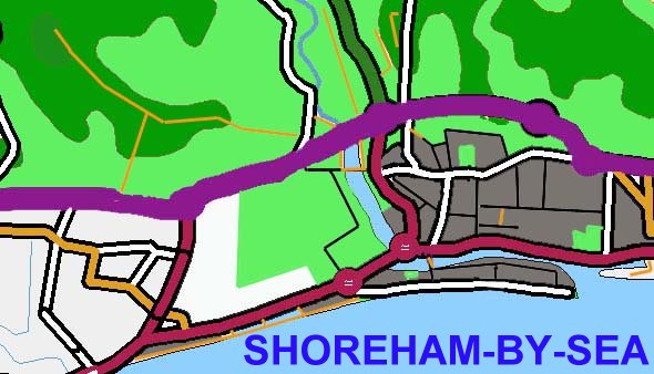
MAP OF SHOREHAM-BY-SEA
Street Map (Multi-map) for Shoreham-by-Sea
The map below tales too long to load. A replacement is planned. Meanwhile, the following site is recommended:
Grid References & Maps on the Web
Also a map at:
Alta
Vista Maps
Town Centre Map (Netscape *)
River Adur at Old Shoreham
Business and Trade
The existence and development of Shoreham as a town depended on its harbour. Over the centuries its fortunes collapsed when the harbour silted up.Business is now diverse with the harbour not so important since the closure and demolition of the Gas Works and the Power Station. Other businesses to close in recent times include the Cement Works, boat building, timber importation and distribution, aircraft construction (Beagle) and flight simulation. Important employers include Southlands Hospital, Adur District Council, BOC Edwards High Vacuum and Ricardo Consulting Engineers, a high technological engineering firm on the west side of the Toll Bridge crossing the River Adur at Old Shoreham. The Airport is an important provider of employment. Aircraft movements can reach 8,000 per month during the summer.
Tourism has not been encouraged and Adur Council have always been ambivalent about it.
The number of jobs in the
Adur District is 18,000 (1991). The official population of Shoreham and
Southwick together is 31,385. Unemployment in the Adur District has been
above the West Sussex County average for 10 years up to 1998. More.
- Ancient Times
- Prehistoric Sussex Link
- About 4070 BC (Neolithic Age) there is evidence that flint was mined at Church Hill near Worthing (5 miles west of Shoreham), about 900 years before the construction of Stonehenge. Neolithic farmers cleared the wildwood to plant crops, using the hoe, and raise livestock. Neolithic relics have also been found at Truleigh Hill, on the downs north of Shoreham.
- By 1100 BC (possibly as early as 1800 BC) a Bronze Age settlement became established near Stoney Lane in what is now Shoreham. A Bronze Age burial site was found on the downs north of Buckingham Park.
- By 500 BC a hill fort had been constructed at Thundersbarrow on the downs. Iron ore was mined in Sussex (north of Horsham, about 25 miles north of Shoreham) about this time. The Truleigh Hill field system (terraced lynchet) has been identified from the Iron Age.
- About AD 40 coins found in Shoreham were those minted in the reign of Tincommius, a Celtic King. By AD 44, this part of Sussex was ruled by the Belgic ruler Coggidumnus at the time of the Roman invasion. The Belgae introduced a heavy plough known as the "ard" and together with the use of iron tools, agriculture production and landscape alteration of the downs was extensive.
- Romano-British settlements existed in Shoreham from about AD 100 to AD 250. Iron Age and Romano-British remains have been found near Slonk Hill, NE of Buckingham Park. Roman coins have been found in Shoreham. Remains of a Roman Villa have been discovered in what is now the town of Southwick to the east.
- Buried hoard of Roman coins of gold and silver, dated between AD 380-461, was found at Patching, now part of Worthing.
- The Saxons arrived in Sussex about AD 457. The first positive evidence of Saxon settlement in this area comes from a Saxon weaving hut at Erringham at the top of the slope on an arable part of the downs near Mill Hill. The date for this is about AD 850. Remains of molluscs showed oysters to be the most important followed by mussels. Ash (aesc) was an important wood for the Saxons, used for the handles of spears (90% of armed men) and swords (10%). Parts of the west wall of the church of St. Nicolas at Old Shoreham have been dated to around this time (AD 850), or earlier.
- St. Nicolas Church
-

- St. Nicolas Church was extensively altered by the Normans in the 11th Century
- At about AD 965 the shoreline was different from the present. The River Adur was navigable as far upstream as Beeding or Bramber about three miles to the north of Old Shoreham. At the time of the Norman Conquest ships could reach St. Cuthmans (Steyning), a further mile north, which was a thriving port. The first bridge crossing at Bramber erected at the time of Bramber Castle (now in ruins) about AD 1086 sometimes prevented navigation further upstream. A timber quay was erected at Bramber about this time (between AD 1010 and 1170).
- In the 11th century the Norman's established Shoreham as important haven. The church of St. Mary de Haura is dated at AD 1103.
See Shoreham-by-Sea 4 for Historical Snippets.
Once the sea had crawled at high tide half-way up the sloping sides of those downs. It would do so now were it not for the shingle bank which its surging had thrown up along the coast. Between the shingle bank and the shore a weedy river flowed and the little town stood clamped together, its feet in the water's edge. There were decaying shipyards about the harbour, and wooden breakwaters stretched long, thin arms seawards for ships that did not come.George Brown: Esther Waters
Adur Valley: Nature Notes 2006Page compiled by Andy Horton
Local Councillors
Religion in the Adur District (Churches)
Shoreham-by-Sea 3: Wildlife Habitats
Shoreham-by-Sea 4: More about the Town
Shoreham-by-Sea Home Page
BMLSS Home Page
Shoreham-by-Sea 9 Diary of Events
|
TOP OF THE PAGE |
 |
|
|

UK Environment and Planning EFORUM PAGE |
